10 Best Hiking Trails Near Sugar Mountain, North Carolina
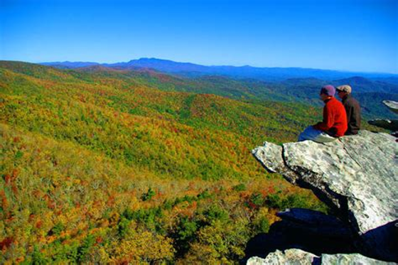
From open-rock overlooks and rhododendron tunnels to waterfall loops and ladder-assisted ridgelines, the North Carolina High Country packs remarkable variety into a relatively compact mountain landscape. Sugar Mountain sits close to Grandfather Mountain State Park, the Blue Ridge Parkway, Pisgah National Forest and Linville Gorge Wilderness, while the Roan Highlands and Cherokee National Forest expand the possibilities farther west and north. [1]
That geography makes SugarTop Resort a convenient home base for a North Carolina hiking vacation. Guests can choose a short sunset walk one day, a waterfall-and-wildflower loop the next, and a demanding summit hike after that—then return to an indoor pool, hot tubs and other shared resort amenities. [2]
Important access note: Trail and road conditions remain unusually changeable following Hurricane Helene and ongoing Blue Ridge Parkway construction. As of August 1, 2026, the Parkway has closures and detours near Moses Cone Memorial Park, Price Park, Linn Cove and Linville Falls. The lower streamside portion of the Profile Trail also remains closed, although its parking area and upper section have reopened. Always check the official Parkway, state-park or national-forest status page on the morning of your hike. [3]
Why Sugar Mountain Works as a Hiking Base
The Blue Ridge Mountains around Sugar Mountain rise quickly from deep valleys to summits above 5,000 feet. Grandfather Mountain’s Calloway Peak reaches 5,946 feet, while Elk Knob rises to 5,520 feet. Those elevation changes create several ecological zones, from hardwood forest and creek valleys to exposed rock, spruce-fir communities and wind-shaped summit vegetation. [4]
Pisgah National Forest’s Grandfather Ranger District protects almost 200,000 acres across Avery, Watauga, Burke, Caldwell, McDowell and Buncombe counties. It includes Linville Gorge, waterfalls, backcountry routes and some of the region’s wildest terrain. The Blue Ridge Parkway adds approximately 300 miles of hiking trails across its full length, including many of the easiest-to-reach hikes near Sugar Mountain. [5]
Cherokee National Forest lies across the Tennessee side of the broader High Country and contains more than 700 miles of nonmotorized trails. Its Roan Highlands section includes high-elevation balds, spruce-fir habitat, Appalachian Trail access and prolific early-summer rhododendron displays. Those hikes make worthwhile additions to a longer stay, although this guide concentrates on trails closer to SugarTop Resort. [6]
The driving estimates below begin at 303 Sugar Top Drive, Sugar Mountain and are intended for trip planning rather than turn-by-turn navigation. Mountain roads, weather, construction and seasonal Parkway gates can significantly change both mileage and travel time. [7]
Trail Comparison at a Glance
| Trail | Round-trip distance | Approximate gain | Difficulty | Approximate drive from SugarTop | Best for |
|---|---|---|---|---|---|
| Beacon Heights | 0.6 mile | 150 feet | Easy to moderate | 20–25 minutes | Families, picnics and sunset |
| Rough Ridge | 1.2 miles | 375–480 feet | Moderate | 25–35 minutes | Iconic views and photography |
| Green Knob | 2.3 miles | About 500 feet | Moderate | 35–45 minutes | Forest, creeks and meadows |
| Boone Fork | 5.5 miles | About 500–600 feet | Moderate to strenuous | 35–45 minutes | Waterfalls and varied scenery |
| Flat Top Tower | About 5.2 miles | About 620 feet | Moderate | 40–50 minutes | Gradual walking and panoramas |
| Elk Knob Summit | 3.8 miles | About 950–1,000 feet | Moderate to strenuous | 50–60 minutes | High summit views |
| Nuwati to Storyteller’s Rock | About 3 miles from parking | About 590 feet | Easy to moderate | 30–45 minutes | Quieter family adventure |
| Grandfather Trail | 4.8 miles | Almost 1,800 feet | Advanced | 15–20 minutes | Ladders, cables and major challenge |
| Linville Falls Erwins View | 1.6 miles | Several hundred feet | Moderate | 35–45 minutes | Waterfalls and overlooks |
| Hawksbill Mountain | 2.2 miles | About 700 feet | Moderate to strenuous | 50–65 minutes | Linville Gorge panoramas |
Trail measurements can vary slightly according to the precise turnaround point, GPS device and route taken. The distances above use official figures where available and recent regional trail guides for elevation estimates not published by the managing agency. [8]
Best Trails Near Sugar Mountain
Beacon Heights
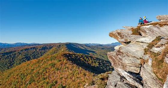
Beacon Heights is the best introduction to Blue Ridge hiking for travelers who want a large scenic reward without committing half a day. The trail climbs through a rocky forest before splitting toward two broad quartzite outcrops. One side looks toward Grandfather Mountain; the other opens toward Table Rock, Hawksbill Mountain, Linville Gorge and the Piedmont. [9]
Trail details: Allow approximately 30 minutes to one hour for the 0.6-mile round trip. The route gains about 150 feet and is short but uneven, with stone steps, roots and exposed rock. It begins at Blue Ridge Parkway Milepost 305.2. [10]
Insider tip: The small parking area has only about nine spaces and no restroom, so arrive early on weekends and during fall color. Beacon Heights is especially attractive near sunrise or sunset, but carry a headlamp and avoid the exposed rock when thunderstorms threaten. Moss and lichen grow slowly on the summit, so remain on established paths and durable rock. [11]
Rough Ridge
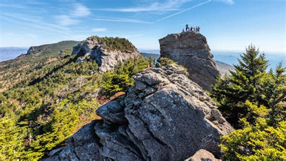
Rough Ridge is one of the most recognizable Blue Ridge Parkway hikes. The trail is part of the longer Tanawha Trail and climbs from Milepost 302.8 to a boardwalk, rock outcrops and open views of Grandfather Mountain, Linn Cove Viaduct and layered ridges descending toward the Piedmont. [12]
Trail details: The popular overlook route is approximately 1.2 miles round trip, gains roughly 375 feet and normally takes 30 minutes to one hour. Continuing beyond the boardwalk toward the higher ridge extends the hike and increases both elevation gain and exposure. [13]
Insider tip: Rough Ridge is extremely popular during summer weekends and autumn foliage. Begin early, stay off closed restoration areas and never step beyond barriers for a photograph. The surrounding plant communities are fragile, and current roadwork may require a detour or access from a different Parkway direction. [14]
Green Knob Trail
Green Knob offers a more intimate experience than the open overlooks. Beginning near Sims Pond at Milepost 295.9, the loop follows Sims Creek beneath mature trees, crosses through rhododendron and climbs into pasture before descending toward Parkway views of Calloway Peak and Price Lake. [15]
Trail details: The National Park Service rates this 2.3-mile loop as moderately strenuous. Regional route measurements place the elevation gain near 500 feet, with most hikers needing about 90 minutes. [16]
Insider tip: Hike after several dry days. The creek crossings and steeper descent can be slick when muddy. The loop is ideal for travelers who prefer forest, water and meadows to a crowded summit, but current Parkway work near Price Park may affect the normal approach. [17]
Boone Fork Trail
Boone Fork is arguably the most varied hike in the area. Its loop passes clear streams, open meadows, rhododendron tunnels, large rock formations and repeated creek crossings. A side destination commonly called Hebron Falls or Boone Fork Falls adds tumbling water and excellent photography to the experience. [18]
Trail details: The official loop is 5.5 miles and rated moderate to strenuous, with at least three hours of daylight recommended. Local measurements generally place the cumulative climb around 500 to 600 feet, although wet rocks, roots and stream crossings make the route feel more demanding than that figure suggests. [19]
Insider tip: Begin at the Price Park Picnic Area at Milepost 296.4, where restrooms and picnic tables are normally available seasonally. Families who do not want the full loop can enjoy the first TRACK Trail section or walk partway toward the falls. Avoid the route after heavy rain, when creek crossings can become difficult. Construction near Price Park may affect vehicle access, so verify the approach before leaving SugarTop. [20]
Flat Top Tower at Moses Cone Memorial Park
The walk to Flat Top Tower follows one of Moses H. Cone Memorial Park’s historic carriage roads. The gradual route passes meadows, woods, remnants of former orchards and the Cone family cemetery before reaching a lookout tower on Flat Top Mountain. The tower provides broad views across Boone, Blowing Rock and the surrounding High Country when visibility is good. [21]
Trail details: Route measurements vary from about 5.2 to 5.7 miles round trip, with roughly 600 to 650 feet of gradual elevation gain. Most visitors should allow two and a half to three hours. Because the path was designed for horse-drawn carriages, the grade is gentler than many single-track summit trails. [22]
Insider tip: These are shared-use carriage roads, so hikers may meet horses, runners or winter cross-country skiers. Yield courteously and keep pets under control. The current Parkway closure begins near Cone Manor and Price Lake, although the manor itself was listed as accessible from the Blowing Rock side on August 1, 2026. Confirm access before departure. [23]
Elk Knob Summit Trail
Elk Knob trades the crowds of Grandfather Mountain for a steady climb to a 5,520-foot summit north of Boone. The well-graded trail uses switchbacks, rockwork and occasional benches to reach separate viewpoints over the North Carolina High Country and mountains extending toward Tennessee and Virginia. [24]
Trail details: The summit hike is approximately 3.8 miles round trip with close to 1,000 feet of elevation gain. It is best described as moderate to moderately strenuous, usually requiring two to three hours depending on pace and summit time. [25]
Insider tip: Day use is free, and leashed pets are permitted. The summit can be several degrees colder and windier than the parking area. Elk Knob is also one of the region’s better winter options for prepared visitors because the park allows snowshoeing and cross-country skiing on approximately one mile of ungroomed trail, though road and trail conditions must still be checked. [26]
Nuwati Trail to Storyteller’s Rock
Nuwati is a strong choice for families who want a genuine mountain hike without Grandfather Mountain’s ladders and exposed ridges. The trail follows an old logging road through rocky forest, stream crossings and a stand of bigtooth aspens before ending near Storyteller’s Rock and its view into the Boone Bowl. [27]
Trail details: Nuwati itself is 1.2 miles one way. With the Tanawha connector from Boone Fork Parking Area, the excursion to Storyteller’s Rock is roughly three miles round trip and gains about 590 feet. The terrain is generally easy by Grandfather Mountain standards, although rocks, roots and stream crossings justify an easy-to-moderate rating. [28]
Insider tip: A free hiking permit must be completed at the trail-access kiosk. Boone Fork Parking Area at Parkway Milepost 299.9 remains accessible from at least one direction during current construction, while the Asutsi Trail off U.S. 221 provides an alternative east-side approach. Do not confuse this parking area with the separate Boone Fork Trail at Price Park. [29]
Grandfather Trail
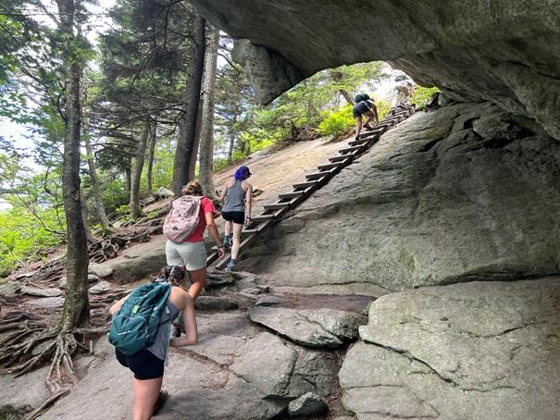
Grandfather Trail is the most technical and adventurous hike in this guide. Beginning near the Mile High Swinging Bridge attraction, it follows the crest across MacRae Peak and Attic Window toward Calloway Peak. Extra-steep sections use fixed ladders and cables, while exposed rock and rapid weather changes demand good judgment. [30]
Trail details: The full out-and-back route to Calloway Peak is 4.8 miles with almost 1,800 feet of cumulative gain. The managing foundation recommends at least five hours because even capable hikers may average only about one mile per hour across the rugged terrain. This is an advanced hike, not a beginner trail. [31]
Insider tip: Access from the attraction requires paid admission and advance reservations are highly recommended. Adult admission in 2026 varies by demand tier, and hiking trails close at least one hour before the attraction closes. Hikers uncomfortable with exposure should not attempt the ladder sections; the Underwood Trail bypasses part of the MacRae Peak ladder route but remains strenuous. [32]
Linville Falls and Erwins View
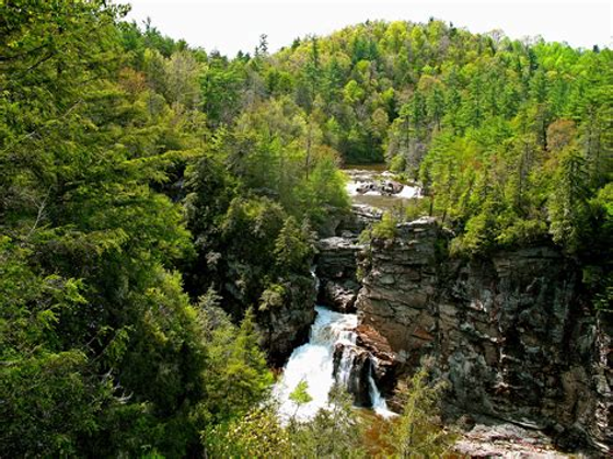
Linville Falls gives families, first-time visitors and photographers several perspectives on one of the region’s signature waterfalls. The river widens above the falls, enters a narrow canyon and then plunges 45 feet into Linville Gorge. Four overlooks along Erwins View Trail reveal the upper falls, lower falls and gorge from progressively different angles. [33]
Trail details: Erwins View Trail is a moderate 1.6-mile round trip. The first viewpoint is about half a mile from the visitor center, while Chimney View and the final overlooks add steeper climbing. Allow one to two hours, particularly if stopping for photographs. [33]
Insider tip: The Linville Falls spur road was open on August 1, 2026, but the campground and picnic area remained closed because of Helene damage. The trail system and parking situation can change independently, so check the current NPS notice rather than assuming all facilities share the same status. [34]
Hawksbill Mountain
Hawksbill Mountain delivers one of the most dramatic summit views in Western North Carolina for relatively few miles. The trail climbs through hardwood forest and rhododendron before opening onto rocky viewpoints above Linville Gorge, where the Linville River lies roughly 2,000 feet below. [35]
Trail details: Current route information lists approximately 2.2 miles round trip, about 700 feet of gain and a hiking time of 90 minutes to two and a half hours. The short distance can be misleading: the upper section is steep and rocky, and the summit has unprotected drop-offs. [36]
Insider tip: The trailhead sits on a bumpy, unpaved Forest Service road with a small gravel parking area and no restroom or water. Drive slowly, reconsider the trip in a low-clearance vehicle after storms and keep children and pets close at the exposed summit. Portions of the wider Linville Gorge trail system remain closed or damaged, so do not improvise a longer loop without checking the Forest Service closure map. [37]
Ready-Made Hiking Days
Relaxed Family Hiking Day
Begin with Beacon Heights early in the morning, when the small parking area is less likely to be full. Bring breakfast or a picnic and enjoy both rock outcrops before crowds build. If energy remains, continue to Linville Falls for the first one or two Erwins View overlooks rather than pushing every family member to the final viewpoint. [38]
Return through Linville or Banner Elk for lunch, then spend the late afternoon at SugarTop’s indoor pool or hot tubs. This itinerary combines two short hikes with very different scenery while leaving enough flexibility for young children, changing weather or a leisurely meal. SugarTop’s official amenities include an indoor pool, jacuzzi and exercise facilities. [39]
Full Adventure Day
Experienced hikers can reserve a morning entry at Grandfather Mountain and devote the day to Grandfather Trail. Begin as soon as the attraction permits trail access, carry enough water and turn around early if wind, wet rock, fog or thunderstorms develop. The full Calloway Peak route requires at least five hours under favorable conditions. [40]
A less technical alternative is Boone Fork Trail followed by dinner in Banner Elk. The 5.5-mile loop still provides a substantial workout, but replaces cliff exposure and ladders with creeks, boulders, meadow scenery and waterfall access. [41]
Photographer’s Mountain Tour
Start at Rough Ridge shortly after sunrise, provided access is open and the forecast is clear. Follow with Green Knob or Boone Fork for forest, stream and wildflower images during softer midmorning light. Finish at Beacon Heights for late-day views across Grandfather Mountain and Linville Gorge. [42]
For a more remote photography day, substitute Hawksbill Mountain for the Parkway stops. Sunrise and sunset light can be spectacular there, but the gravel approach, exposed rock and lack of facilities make daylight scouting and careful preparation essential. [36]
Seasons, Gear and Safety
Spring
Spring brings stronger waterfall flow, emerging wildflowers, muddy trails and variable high-elevation weather. Rhododendrons and mountain laurel bloom at different times according to species and elevation, with many displays extending from late spring into July. Stream crossings on Boone Fork and Nuwati deserve particular caution after heavy rain. [43]
Summer
Summer usually offers long daylight and cooler temperatures than lower-elevation communities, but afternoon showers and thunderstorms are common along the Parkway. Begin exposed hikes early and leave ridgelines when thunder is heard or dark clouds approach. [44]
Fall
Autumn combines cooler hiking temperatures with the region’s most popular scenic season. Color timing shifts with elevation and weather, although the Parkway notes that foliage commonly develops from mid- to late October. Expect limited parking at Rough Ridge, Beacon Heights and popular trailheads, and begin early rather than parking outside designated areas. [45]
Winter
Ice and snow frequently close Parkway sections, and exposed trails can become hazardous even when nearby valleys are clear. Elk Knob offers designated snowshoeing and cross-country skiing opportunities, while Grandfather Mountain publishes separate winter hiking guidance and may close upper areas because of wind, ice or snow. [46]
What to Carry
For short overlook walks, bring water, sturdy footwear, a rain layer, sun protection and a downloaded map. For Boone Fork, Elk Knob, Nuwati, Hawksbill or Grandfather Trail, add food, a headlamp, first-aid supplies, extra insulation, trekking poles and an offline navigation backup. NPS guidance recommends water, rain protection, a first-aid kit, a hiking companion and enough time to finish before dark. [47]
Bear spray is optional for many visitors, but it is reasonable on quieter backcountry routes when carried legally and used correctly. The NPS specifically recommends carrying bear spray and knowing how to use it in black-bear country. Never use food, firearms or a loose dog as a wildlife-safety strategy. [48]
Keep dogs on a leash no longer than six feet on the Blue Ridge Parkway and in North Carolina state parks. Not every dog is suited to ladders, exposed rock or long creek crossings, and the upper Daniel Boone Scout Trail is specifically discouraged for pets. [49]
Cell service and GPS can be unreliable, particularly around the Parkway and Linville Gorge. Download maps before leaving, tell someone your route and return time, carry a headlamp and remain on designated trails. Pack out trash, food scraps and pet waste, and leave rocks, plants and historic objects where you find them. [50]
Frequently Asked Questions
What is the best hike near Sugar Mountain?
For the largest view with the least mileage, choose Beacon Heights. For a half-day hike with water, meadow and forest scenery, choose Boone Fork. Experienced hikers seeking the region’s most demanding adventure should consider Grandfather Trail only in good weather and with adequate time. [51]
Which hikes are easiest?
Beacon Heights is the shortest featured option, while Nuwati is one of the gentlest true backcountry trails. The first overlook on Linville Falls’ Erwins View Trail is also manageable for many casual hikers, although none of these natural-surface routes should be described as fully accessible. [52]
Which trails have the best views?
Rough Ridge provides the classic Grandfather Mountain and Linn Cove perspective. Hawksbill delivers the most dramatic Linville Gorge panorama, while Grandfather Trail offers multiple high-elevation ridgeline views reached through much harder terrain. [53]
Are the trails dog-friendly?
Leashed dogs are allowed on Blue Ridge Parkway trails and at Elk Knob State Park, but technical ladders, exposed cliffs and rough rock can make some routes unsuitable. Confirm the rule for each managing property, keep the leash at six feet or shorter and never allow a dog to chase wildlife. [54]
Are permits or fees required?
Most Parkway and state-park day hikes are free. Grandfather Mountain State Park requires hikers to complete a free permit at trailhead kiosks, while the privately operated Grandfather Mountain attraction charges admission for access from the Swinging Bridge area. Linville Gorge may require permits for certain overnight stays, particularly on weekends and holidays from May through October. [55]
Can beginners hike Grandfather Mountain?
Beginners can explore easier Grandfather-area options such as Nuwati or some attraction-side nature trails, but Grandfather Trail is advanced and uses ladders and cables. The Profile Trail is strenuous even under normal conditions and, as of August 1, 2026, its lower streamside section remains closed. [56]
Is parking available?
Every featured hike has an established parking area, but capacity varies considerably. Beacon Heights and Hawksbill have small lots, while Price Park and Moses Cone normally offer more space. Construction, weather and seasonal closures can make an otherwise open trail difficult to reach, so checking both trail status and road access is essential. [57]
[1] [4] [29] [55] Grandfather Mountain State Park: Home | NC ...
https://www.ncparks.gov/state-parks/grandfather-mountain-state-park?utm_source=chatgpt.com
[2] [39] Amenities
https://www.sugartop.com/amenities/?utm_source=chatgpt.com
[3] [34] Road Status and Closures - Blue Ridge Parkway (U.S. National Park Service)
https://www.nps.gov/blri/planyourvisit/roadclosures.htm
[5] Grandfather Ranger District, Pisgah National Forest
https://www.fs.usda.gov/r08/northcarolina/recreation/grandfather-ranger-district-pisgah-national-forest?utm_source=chatgpt.com
[6] Cherokee National Forest
https://www.fs.usda.gov/r08/cherokee?utm_source=chatgpt.com
[7] Contact Us – Sugar Mountain Condos
https://www.sugartop.com/contact/?utm_source=chatgpt.com
[8] [9] [10] [11] [38] [51] [52] [57] Beacon Heights Trail
https://www.exploreasheville.com/article/beacon-heights-trail?utm_source=chatgpt.com
[12] [14] Rough Ridge Hike, Blue Ridge Parkway
https://seesugar.com/rough-ridge/?utm_source=chatgpt.com
[13] [42] [53] Rough Ridge on the Tanawha Trail
https://www.exploreasheville.com/article/rough-ridge-tanawha-trail?utm_source=chatgpt.com
[15] [16] Julian Price Park Hiking Trails - Blue Ridge Parkway (U.S. National Park Service)
https://www.nps.gov/blri/planyourvisit/julian-price-trails.htm
[17] Blue Ridge Parkway | GREEN KNOB TRAIL (MP 295) |
https://npplan.com/parks-by-state/north-carolina-national-parks/blue-ridge-parkway-park-at-a-glance/blue-ridge-parkway-hiking-trails/blue-ridge-parkway-julian-price-park-hiking-trail-mp-295-298/blue-ridge-parkway-green-knob-trail-mp-295/?utm_source=chatgpt.com
[18] [19] [41] Julian Price Park Hiking Trails - Blue Ridge Parkway (U.S. ...
https://www.nps.gov/blri/planyourvisit/julian-price-trails.htm?utm_source=chatgpt.com
[20] Boone Fork Trail Guide | Hiking near Boone, NC
https://www.exploreboone.com/outdoors/hiking/boone-fork-trail/?utm_source=chatgpt.com
[21] [23] [43] Moses Cone Park Trails - Blue Ridge Parkway (U.S. National Park Service)
https://www.nps.gov/blri/planyourvisit/moses-cone-trails.htm
[22] Flat Top Tower Hike - Blowing Rock, NC
https://myhikes.org/trails/flat-top-tower-hike?utm_source=chatgpt.com
[24] [26] Elk Knob State Park: Home | NC State Parks
https://www.ncparks.gov/state-parks/elk-knob-state-park
[25] Elk Knob State Park (3.8 miles; d=5.64)
https://www.dwhike.com/Hikes-in-the-South/North-Carolina-Hikes/North-Carolina-State-Park/Elk-Knob-NC?utm_source=chatgpt.com
[27] East Side Trails
https://grandfather.com/east-side-trails/?utm_source=chatgpt.com
[28] [56] Grandfather Mountain: Trails | NC State Parks
https://www.ncparks.gov/state-parks/grandfather-mountain-state-park/trails
[30] [31] [40] Grandfather Trail
https://grandfather.com/grandfather-trail/?utm_source=chatgpt.com
[32] Tickets & Online Reservations
https://grandfather.com/tickets/?utm_source=chatgpt.com
[33] Linville Falls Hiking Trails - Blue Ridge Parkway (U.S. ...
https://www.nps.gov/blri/planyourvisit/linville-falls-trails.htm?utm_source=chatgpt.com
[35] [36] [37] Hawksbill Mountain Trail
https://www.exploreasheville.com/article/hawksbill-mountain-trail?utm_source=chatgpt.com
[44] [46] Weather - Blue Ridge Parkway (U.S. National Park Service)
https://www.nps.gov/blri/planyourvisit/weather.htm?height=80%25&iframe=true&width=80%25&utm_source=chatgpt.com
[45] [49] [54] Frequently Asked Questions - Blue Ridge Parkway (U.S. ...
https://www.nps.gov/blri/faqs.htm?utm_source=chatgpt.com
[47] Hiking - Blue Ridge Parkway (U.S. National Park Service)
https://www.nps.gov/blri/planyourvisit/hiking.htm?utm_source=chatgpt.com
[48] Bear Safety - Blue Ridge Parkway (U.S. ...
https://www.nps.gov/blri/planyourvisit/bear-safety.htm?utm_source=chatgpt.com
[50] Trail Safety - Blue Ridge Parkway (U.S. ...
https://www.nps.gov/blri/planyourvisit/trail-safety.htm?utm_source=chatgpt.com